 |
 |
|
|
|
|
|
|
|
|
|||
|
|
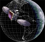
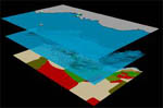
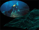
Managing problems involved in territorial planning can be very difficult due to the amount of information and their multidisciplinary nature. Territorial Informative Systems defined using the GIS technology may supply a great help in facing such problems, providing the best solution to collect, analyse and manage data. Our company offers high-tech services concerning the application of GIS technology in the coastal marine environment:
|
||
Antheus s.r.l. c/o Di.S.Te.B.A. University
of Salento, Ecotekne, Via Monteroni 73100 Lecce (ITALY)
tel +39-0832298853 - fax +39-0832298626 - P.IVA 04045770759
tel +39-0832298853 - fax +39-0832298626 - P.IVA 04045770759